
Finding Moreno Valley Addresses by Street
A Moreno Valley street directory search works best as an address chain. Start with the exact street number and name, keep the ZIP as a check, and treat the result as a way to identify land rather than a promise about a household. The assessor and GIS systems are address-keyed. The recorder is party-keyed, so it becomes useful only after an address has been translated into an owner name or durable parcel identifier.
The same order works for a whole street. Process one parcel at a time, save the APN or legal description, and note where the chain changes from current property facts to historical listed occupants. The sequence below follows the records actually available in Riverside County.
- Enter the street number and street name in the Riverside County assessor property search, then save the APN, PIN, situs address, map reference, and legal description.
- Open Riverside Map My County and search by street, address plus street, APN, or tract to confirm the parcel and view neighboring lots.
- Inspect the current assessed owner at an ACR office because the online assessor result suppresses the owner name.
- Search that owner as a grantee in the recorder index, order the instrument, and verify the legal description before following the earlier grantor.
- Use permitted voter information, city permits, and a historical criss-cross directory only as separate evidence with its own date and access rule.
Once the goal changes from the street to one person, the Moreno Valley resident lookup workflow keeps court, vital, and identity checks separate from the address chain.
Moreno Valley Parcel Search Fields
The Riverside County Assessor Property Search is the first detailed stop for this address. It is free and accepts one search key at a time. A street number plus street name is the practical entry when the address is known. An APN or the first nine digits of a PIN is more stable when a street label has changed or when a deed must be matched later.
| Search key | Type | Required | Format or result |
|---|---|---|---|
| Assessor Parcel Number | Text | One key | Use the county APN format. |
| Property Identification or Assessment Number | Text | One key | First nine digits only, without dash or check digit. |
| Property Address | Text | One key | Street number and street name produce the best result. |
The Riverside parcel valuation page can return the APN or GeoCode, situs address, property type, legal description, subdivision, lot or parcel, acreage, map book and page, valuation year, value history, tax information, similar sales, and property report. Valuation data is described as updated weekly.
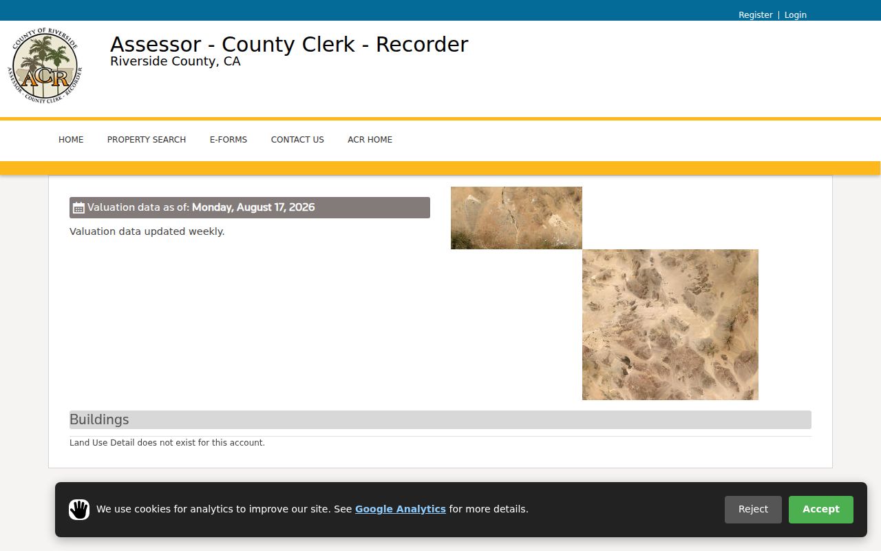
The parcel result is a firm anchor for the address trail. It does not display the owner name or mailing address online. Those ownership details are available for public inspection at an assessor office, not through an online name browse.
Moreno Valley Records by Address
Address-keyed records overlap without becoming interchangeable. An assessor page describes land and assessment facts. A GIS layer shows map context. A deed proves what an instrument records about named parties and legal land. A permit dates work or identifies an applicant. A historical directory records a listed person at a point in time. The table separates those claims so parcel research does not turn a land fact into a household fact.
| Record set | Keeper | What an address can show | Access |
|---|---|---|---|
| Assessor parcel | Riverside ACR | APN, PIN, situs, values, legal and map facts | Free web; owner at office |
| MV2 GIS | Riverside County map viewer | Parcel, zoning, districts, aerials, service schedules | Free viewer and export tools |
| Deeds and liens | Riverside recorder | Named parties, transactions, encumbrances, legal description | Name index; copies ordered |
| Permits and planning | Moreno Valley Community Development | Work dates, applicant, contractor, project descriptors | Portal or request; coverage varies |
| Criss-cross directory | Libraries and archives | Listed occupant by address and year | Verified Riverside examples; local run needs confirmation |
| Voter file | SOS or Registrar | Registration address under a permitted purpose | No casual street browse |
A complete street pass may therefore require the online parcel page, the map viewer, an ACR counter visit, recorder copies, city records, and a library or archive stop. The absence of a name in one layer is not evidence that the person was never connected to the address.
Situs, Mailing, and Residence in Moreno Valley
Situs is the physical parcel location. Mailing is where assessment correspondence goes and may belong to an owner who is not at the parcel. Residence is a separate claim that the assessor, recorder, and GIS viewer do not establish on their own. Address research must preserve those distinctions because the same Moreno Valley address can be tied to a deed party, an out-of-area mailing address, a business, or a historical listing without identifying every household member.
The APN, legal description, and map book and page are more durable than a street label. They help when a parcel has a new address, a renamed street, a subdivision reference, or a different postal designation. A homestead exemption can be a clue, but it is not conclusive occupancy evidence. Permits and utility infrastructure date a building or project, not each person who used it.
- Parcel
- A mapped unit of land carried by an APN and legal description.
- Situs address
- The physical location used to place the parcel on the ground.
- Plat
- A recorded map that lays out lots, blocks, streets, and related boundaries.
- Criss-cross directory
- A reverse directory section read from an address to a listed householder, then checked in an alphabetical name section.
Keeping these terms in view is the difference between an address research result and an unsupported claim about a Moreno Valley resident.
Moreno Valley MV2 Street Browse
Riverside County's Map My County viewer provides the map layer needed after the assessor lookup. Its search modes include Street autocomplete, Address plus Street autocomplete, APN, and Tract. A selected address zooms to the parcel. Point Identify can click one parcel, drag-box identify can select several, and a right-click offers “What's Here.” Query and Filter are separate modes from simple search.
MV2 is useful for walking a street without treating the map as a people list. Search the street, inspect each parcel, and keep the APN beside the map result. The viewer can show parcels and property, aerial imagery, zoning, schools, parks, public facilities, trash pickup, and street sweeping. Zoning variants include Zoning, AICUZ, PUD, ISA, and Residential Buffer. FEMA is an outside flood authority, so its layer should not be mistaken for a county ownership layer.
Use the Riverside Map My County viewer for parcel context, then return to the custodian that owns the record. The GIS viewer is not an address-to-occupant directory.
Moreno Valley Parcel Layers and Reports
MV2's Create Parcel Report accepts an address or APN and can combine assessor, zoning, council-district, trash-pickup, and related map information. Other outputs include a mailing list, street-sweeping calendar, parcel CSV, formatted address PDF or CSV, and a printable map with layout, scale, resolution, title, and notes. These outputs are practical for a street-by-street research log because they keep the selected parcels together.
The Query Tool adds a data source, field, operator, and value, with Add, Add Another Condition, and Search controls. A buffer distance can select parcels that intersect a defined area. A geometry selection or current extent can narrow a block before export. The output is a list of parcels and map attributes, not a verified roster of people. Use it to decide which APNs need a separate ACR or recorder check.
Map practice: Save the printable map or CSV with the search date and chosen layer. A current parcel view and an older deed can describe the same land with different street labels.
Moreno Valley Recorder Name Trail
The Riverside recorder's Advanced Search is the full name-and-date tool behind a street directory deed trail. It accepts Document Number, Recording Date Start, Recording Date End, Name, Document Types, and an Advanced Name Searching checkbox. Search modes also include document type and map type with book and page. Individuals can be entered LAST FIRST MI without punctuation, while an organization is entered as spelled.
Because the recorder is not an address index, the street workflow runs through a person. Obtain the assessed owner at an ACR office, search that person as grantee, and order the deed. Read the deed's grantor, legal description, APN, and recording date. Search the grantor in an earlier period as a grantee. Repeat until the chain reaches the 1974 web cutoff, then take the books and images to Gateway Riverside for earlier research.
The Riverside recorder Advanced Search displays the party, document type, recording date, and document number model. A map result may add map type, book, and page. The full legal description and party role belong to the ordered instrument, not the short index line.
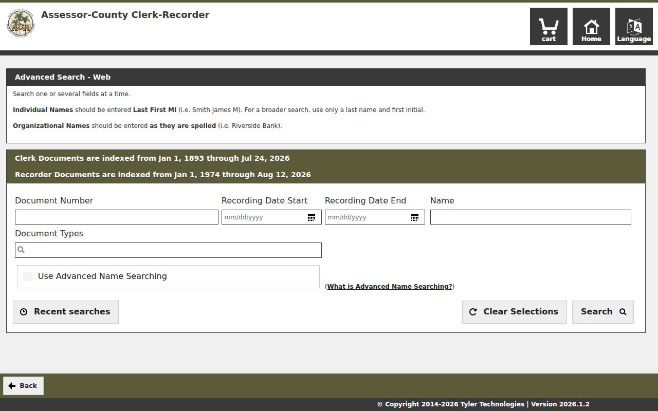
The screenshot's field structure mirrors the actual address-to-name handoff. Copy fees, office terminals, mail requests, drop boxes, and online ordering remain separate channels, so a failed web search should lead to a counter or narrow written request rather than a new guess.
Moreno Valley Permits and Code Records
Community Development records add a construction and planning timeline to the Moreno Valley street directory. The department links to Search Permit Records, Search Code Records, Search Planning Records, SimpliCITY, and property information. A permit can expose a work date, applicant, contractor, and project descriptor. A code record can tie an address to a case, although active enforcement material may be limited or redacted.
Building and Safety can be reached at 951-413-3350, and Planning at 951-413-3206. The land-development research form allows a focused request when an official plan is not in the portal. Plans are viewable on premises as public records. The city describes a typical turnaround of 10 business days for land-development research, with longer timing for extensive work. Grading and erosion-control plans route through City Clerk.
The Moreno Valley Community Development hub is useful for tying a parcel to a project history. It does not identify everyone who occupied a structure, and a contractor or applicant connection is not a residence record.
Use permits to date change, not to fill in an entire household. That limited claim makes the address evidence more reliable.
Moreno Valley Criss-Cross Street Evidence
Historical criss-cross directories reverse the normal name-first path. An address section can identify a listed householder, and the alphabetical section can add an occupation or address clue. Riverside examples documented by historic-resource reports include Luskey volumes from 1951, 1952, 1955, 1963, and 1966. The research does not prove a continuous run for Moreno Valley, so the local library or archive must confirm each volume before a street search relies on it.
Directory evidence is best paired with a deed or census entry. A listed householder may be a subscriber, a resident, or a person connected to the address at publication time. A missing name can reflect a move, death, omission, or an unpublished telephone listing. The historical shelf is therefore a useful past-occupant lead, not a title record.
For the complete historical collection trail, use the Moreno Valley city directories page, which keeps predecessor names, FamilySearch fields, Riverside examples, and the local library and society access routes separate from current address-keyed research.
Why Moreno Valley Voter Data Is Limited
California law does not create a public street directory from voter registration. My Voter Status is a personal lookup. A voter-information file requires an eligible election, scholarly, journalistic, political, or governmental purpose, and commercial use is prohibited. Protected voters and confidential fields are removed. A permitted record can show a registration address at a point in time, but it cannot establish who occupies a parcel today.
The voter file may contain a registration county, unique ID, name, residential and mailing addresses, phone, email, language, birth date, gender, party preference, status, registration date, precinct, method, birthplace, status reason, and vote-by-mail status. It can show election date and voting method, not ballot choices. DMV numbers, Social Security numbers, and signatures remain confidential. A no-result or inactive record also needs careful interpretation.
That access boundary keeps the Moreno Valley street directory from becoming a casual block roster. Use the voter channel only when the request and purpose meet the statutory rule.
What a Moreno Valley Street Directory Cannot Show
A parcel map cannot show every household member, a minor, a utility customer, or a person whose record is protected. A mailing address can belong to a nonresident owner. A permit can identify an applicant without proving residence. A criss-cross listing can be incomplete. DMV personal information is restricted under the federal Driver's Privacy Protection Act, and Safe at Home can substitute a protected mailing address.
Public records are for lawful research. The Riverside assessor, recorder, court, elections office, and city clerk each control a different record and correction process. Keep a source URL, date, APN, document number, case number, or license number rather than repeating an uncertain name. If the goal becomes a one-person identity check, move to the official custodian and use the focused resident lookup route.
Privacy limit: Use address records for lawful personal, family-history, property, or civic research. Do not use a street search to stalk, harass, threaten, or harm anyone.
The strongest Moreno Valley street directory result is modest: it states what the parcel, map, deed, permit, or historical listing supports, and it labels what remains unknown.